This four-part series is about my experiences and lessons learned from bringing the advantages of technology to Indian farmers. Read part 1
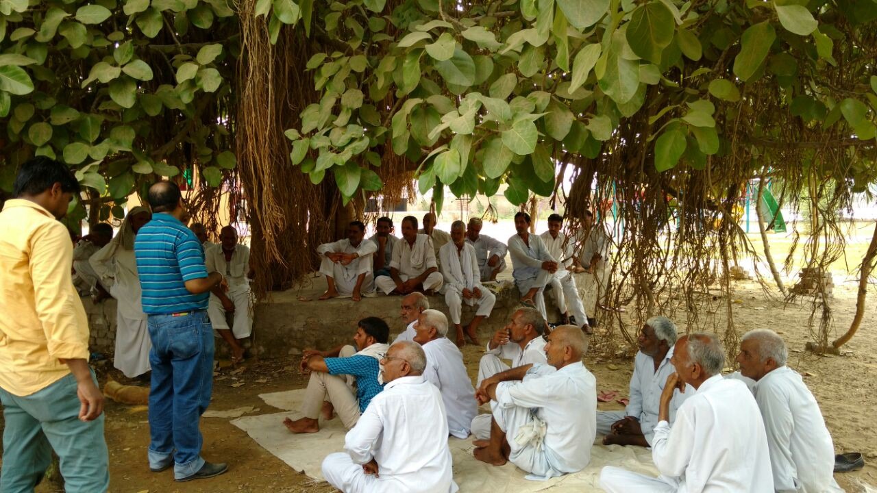
An old farmer was fumbling with his newly bought Android phone stretching his ears to understand instructions from our extension officer. The extension officer who had installed our app on his phone was trying hard to show him how it works. This was one of my many on-site trips to understand the introduction of technology to the farming ecosystem. We were ready with our solution after more than 12 months of hard work and intermediate field testing. It was now time to start engaging our customers — the farmers in remote parts of North-west India. Our business model was based on providing farmers with valuable advisory and farm-to-fork extension services with a reliable and cheaper way to buy inputs and equipment, rent equipment and local storage, provide processing facilities and connect them to wholesale buyers to directly sell their produce.
We decided to concentrate our efforts on a few villages on the boundaries of three north-western states. We rolled out our services to fine-tune our model. It was important to create various touchpoints with farmers to acquire and engage them in our services.
1. On the ground with field officers
We defined geographical clusters of eight to ten villages in two neighboring states. The villages were grouped together based on similarities like access to the Ganga canal, crop selection, language spoken, etc. We assigned two extension officers for each cluster who will reach out to different villages every day such that each village is visited at least once every month.
We developed a mobile app for field officers. Extension officers who were familiar with local dialect used this multi-lingual app to capture answers to comprehensive survey questions that included demographics, location, access to the mobile network, type of phone, land-holding size, access to agri-services, water sources, crop preferences in the last and this year, yield, soil testing, etc. We also captured the latitude and longitude for each corner point of the farmland of the farmer, wherever possible. This allowed us to capture comprehensive data with farmer profiles. The app worked offline and stores data locally if the internet connection is not available. The offline data was synced to the backend server as soon as the phone came into the coverage area. This was important due to the very low penetration of mobile data coverage in remote areas.
We subsequently added order tracking, inventory visibility, farm traceability with photos, and other useful features to the field officer’s app. This app was very useful in facilitating two-way communication with small-holding farmers with no smartphones, not enough skills to operate it, or not enough money to spare to spend on a data plan.
There are a large number of surveys conducted by various government and non-profit agencies in the agriculture sector throughout the year. There are two challenging aspects to this data collection — to define survey questions such that proper data is gathered, and to ensure that the answers are from real farmers and not made up by field staff. We designed a scientific survey that asked multiple-choice questions which we could potentially use for aggregated analytics. The survey asked the officer to take a picture of the farmer at the end. We added the latitude and longitude of the place where the picture was taken to the image metadata in the app. This allowed us to cross-verify farmer locations in the survey with the location data in the image for authenticity.
This method is the most difficult to manage operationally and also the most expensive to scale. It was, at the same time, most effective for signing up new farmers for our services and improving farmer engagement. It is a challenge for any startup or a small company to run at scale such an on-the-ground operation in a cost-effective manner. One way would be to collaborate with the government, NGOs, and other private companies to share technology, staff, and open-source anonymous data for the benefit of all. Another area that would be of great benefit is to associate public land records with GPS location coordinates of farms. Such a connection will open up huge data analytics areas around aerial imaging analytics for various purposes such as logistics, input production planning, marketing, disease detection, and yield prediction.
2. Call Centre and CRM
We established two call centers serving the north and south of the cluster we chose. We used a cloud telephony provider which reduced our initial setup costs and time. The call center executives registered new farmers in our CRM when they called in with their consent. We integrated telephony call center software with CRM so if a registered farmer called, the call center executive to whom the call is routed would see the farmer profile and the history of previous interactions in a popup window on the CRM. This immensely improved the quality of interaction of the call center staff with farmers.
This profile and call data were also made available to the field officer’s survey and sales apps. Also, the survey and sales data from the field officer’s app were available to the call center operator. The operators had access to all the content, services, and inventory data to help them with the rich interaction with the farmers. We trained call center operators on answers to a range of expected queries based on the season of the year and location. We also had two agri-experts present in the call center to route any queries that call center operators could not answer.
All of the call center operators could understand and mostly speak multiple local dialects which simplified communication. One of the lessons was to capture the name of the dialect in the farmer profile and route the call to the call center operator who could understand and speak it. We heard call recordings where farmers were immediately frustrated and hung up if the call center person could not understand them immediately.
The call center was an effective and scalable touchpoint. Most of the farmers had feature phones and did not hesitate to call on a toll-free number. The challenge was to publicize the number through all means including posters and wall paintings in villages. Even if there are a large number of Krishi Call Centers run by the Indian government all over the country, it was interesting to see the big volume of daily calls to our call center. Some of it might be due to a lack of knowledge about government centers or less effective CRM and personalized advice. Krishi call center data including call recordings are publicly available on data.gov.in and could be a good source of analytics on farmers and can help in improving call center effectiveness for the government or agritech companies.
3. Franchisees
It was important for us to increase on-the-ground presence given that it was the most effective way to reach farmers in remote areas. We decided to set up a franchisee model. Franchises spread across the region would be one of the most effective ways to increase the penetration of our services. Franchisees were mostly progressive farmers, traders, or young aspirants in the area. We set up a profit-sharing model requiring some initial investment from the franchisee. We had a franchisee web portal where they could see product prices, local inventory and other service offerings. Training, branding, and setup assistance were given. There was significant interest from young entrepreneurs.
This was one of the effective ways to involve local youth in the agroecosystem without having them go through complicated license applications and huge initial investments.
4. Digital Signage and Touch Screens Kiosks
Farmers frequently visited local agriculture centers. They also visited our franchise locations. We experimented with installing digital signages and touch screen kiosks connected to the internet. We pushed the latest local weather conditions and any pertinent regional information. Digital displays have the advantages of big screens and can show content in a much more attractive way.
One of the challenges was to protect this equipment from theft and provide timely maintenance given that it was installed in remote locations. Though the touch-screen kiosk user interface was intuitive, farmers struggle to navigate it due to unfamiliarity with such interfaces.
5. Farmer App
We developed an Android mobile app and web portal for farmers. This was a direct channel to the farmers, and we wanted to fully utilize it. We could push real-time information to farmers, release new versions of the app easily, expose our services, personalize the content based on farmer profiles, analyze interactions to tune the features and content further, and run campaigns.
The app had the following features:
- Real-time information on weather, local Mandi prices, and regional and national news
- Knowledge-based on crops and best practices
- Group messaging between farmers in the surrounding area
- Q & A farmers to ask questions to our experts
- E-commerce to buy inputs
- Information and registration for our services like Rentals, Warehousing,
- Organic trace-ability and Trading
- My Farm for personalized, seasonal farming advice and exposure to real-time farm information
The app had an intuitive user interface developed for first-time smartphone users with easy navigation, big bold fonts, and visual appeal. The app supported a multi-language feature and would show content in the language in the farmer’s profile. The app registration was simplified using the mobile phone number and auto-filled One Time Password. The onboarding process was kept very simple with four questions asked about the farmer profile. We automatically captured location during app registration, and this was used for further personalization of real-time and crop information.
From a technology perspective, this was the most preferred touch-point though it was the most challenging and least popular amongst farmers due to various reasons. During field meetings, one of the noticeable aspects was the low turnout of younger farmers. Most of the farmers we met were in their 50s and beyond. This also explained low smartphone use among them. Also, mobile data penetration in remote villages was mostly absent or extremely patchy. For those with smartphones and mobile data service, the tendency was to use Rs. 100 data packs mainly to check WhatsApp messages for entertainment. The thought of using a mobile app that would consume precious prepaid balance was not easily acceptable unless the app provided instant gratification or seemed to bring in huge benefits.
Farmers depend heavily on local conditions based on the time of the season, their effect on their specific crops, and market conditions related to their produce. To provide such personalization for deep farmer engagement, we had to design relevant content that would get refreshed at least every 15 days for different crops in different locations based on the season.
Based on the farmer’s attributes set at the registration time and his subsequent interactions with all the touch points, the platform built a rich farmer profile. This was later used to provide targeted useful content. The same content was made available to the farmer through all the touchpoints. The challenge was to build such personalized, localized and seasonal content which may also change year over year. This required a huge investment in a content team backed by agriculture experts who could give practical advice.
6. Analytics and Marketing Campaigns
We gathered data from all the touchpoints in a central data lake. Each farmer was uniquely identified based on the phone number from all the channels. This allowed us to develop a common rich profile for each farmer which was visible across all channels. We extracted and visualized aggregated analytics based on locations, crops, demand, prices, etc. We analyzed Mandi price trends across different locations, crop-sowing patterns, call center query patterns from farmers, weather effects on crop cycles, etc. These analytics was used by our agri-experts to provide useful advice to farmers.
With their consent, we also ran on-ground, out-dials from call center SMS and app push notification campaigns on segmented farmers based on their locations and crop type. SMS campaigns were very effective in dispersing timely advisory for different crops and help tremendously improve farmer engagement with our platform.
In part 3 of this series, I will write about my understanding of various services from the point of view of a farmer. I will talk about my observations on how merely bringing in highly technical solutions may not necessarily solve current problems plaguing the agriculture ecosystem. The role of technology is to act as an enabler and it will only be effective once the surrounding geographic, demographic, political, cultural, and financial factors align together.
Have you been involved in the development of products or providing services for agriculture? I would be glad to hear your perspective.
This article is part of a series of articles that describe our experiences in “building intelligent communities using data”. If you are looking for a product engineering company to build your solution, please contact us at hello@47billion.com.


